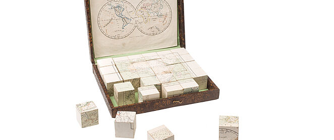
Geography Mosaic
P. Eitner, Verlag C. Flemming, Glogau, around 1860, Deutsches Historisches Museum

The exhibition
In the exhibition ‘German Colonialism. Fragments Past and Present’, featuring more than 500 exhibits, the Deutsches Historisches Museum addresses various aspects of German colonialism for the first time. Although the German Empire was one of the major European colonial powers from 1884 until the end of the First World War, it is only in the past few years that the colonial past has increasingly begun to enter public consciousness in Germany. The exhibition offers fascinating insight into the interests, development and dynamics of German colonial history and tells of the scope of action within which a broad spectrum of German, African and Oceanian players pursued their aims and motives.
Geography mosaic
These cubes with cardboard motifs on all six sides can be arranged to form maps of five continents and the world. The latter half of the 19th century experienced globalization in the modern sense, namely a growing degree of interconnection between all regions of the world. This included new means of communication and transportation, plus growing geographical knowledge and interest. As more European scientists travelled throughout the world, their reports spread images and knowledge of different regions. At the same time, geography became an established and professional scientific discipline in Europe’s metropolitan centres, promoting cognition and cartographic representation of the earth. The growth of geographical knowledge, of which this mosaic is a playful example, was key to European colonialism, both as a practical precondition and as an increasing tendency to think in global categories.